“Somalia – Mogadiscio – In the customs enclosure”
 Approximate location. Lat: 2.036332, Long: 45.351251
View of earliest Italian colonial period wharf
 View looking inland towards Governor’s Palace (later the site of the Al Uruba Hotel)
Note official being carried on a simple type of sedan chair, centre of photo, facing the camera
Postcard posted 1926, but photo may have been taken well before then
Approximate location of camera: Lat 2°02’00.4″N Long 45°20’37.3″E
Colonial period building on the lower Juba
 Photo taken in 1988, at the mouth of the Juba, on the north side of the river.
It could be Italian or English. This area, known as Jubaland, was once under British colonial control
Possible location: Lat and Long 0°14’55.8″S 42°37’04.0″E
-0.248845, 42.617769
Interior views of the Garessa (when used as a museum)

Undated postcard, but likely to be from the 1950s
Undated postcard, but likely to be from the 1950s
Location on Google Maps
For other views of the Garessa at different points in time, see these postings:
2nd World War period – British occupation
 Text on back says “Late Fascist Headquarters. Now Troop Headquarters, Mogadishu”
Lat and Long: 2°02’18.9″N 45°20’29.6″E
2.038593, 45.341569
This became the home of the Parliament, post independence. What was its use before then?
 Text on back says “Another view of the Mosque, Mogadishu. From further up the beach”
Where is this?
 Text on the back says “A well on the outskirts of Mogadishu”
Is this Mosque Sheik Sufi in the background? Your comments below please?
 Text on the back says “Mosque on the seashore, Mogadishu”
Where is this? Leave your comments below
 Text on the back says “Another view of the high school in the centre of the town, Mogadishu”
Where is this exactly?
“Mogadiscio – Viale Cerrina”
 Click on photo to enlarge
Viale Cerrina, later named Via Vittorio Emmanuel, then Via Somalia (I think). Leave your comment below
Fakhr al-Din mosque visible in the centre
 From page 15 of “Mogadishu: Pearl of the Indian Ocean” (pdf copy here)
“Mogadiscio – Campo Amnara”
 Click on photo to enlarge
Campo Amhara, in what was latter called Abdul Caziz District (I think). Centre of town to the right.
Leave your comment on where this is
“Somalia – Mogadiscio – La Fontana della Garesa”
 Click on photo to enlarge
Postcard posted 2/3/1937
“Mogadiscio – Una veduta della citta dalla Cattedrale”
 “A view of the city from the Cathedral”
Looking over the Palace of the Governor on the left and Hotel Croce del Sud in the centre foreground, with Xama Jab Jab in the distant right (I think)
“Somalia – Mogadiscio – La Fontana degli Uffici”
 “The fountain of offices”, in the forecourt of the Palace of the Governor
Post card posted 24/5/1938
“Mogadiscio – Palazzio del Governo”
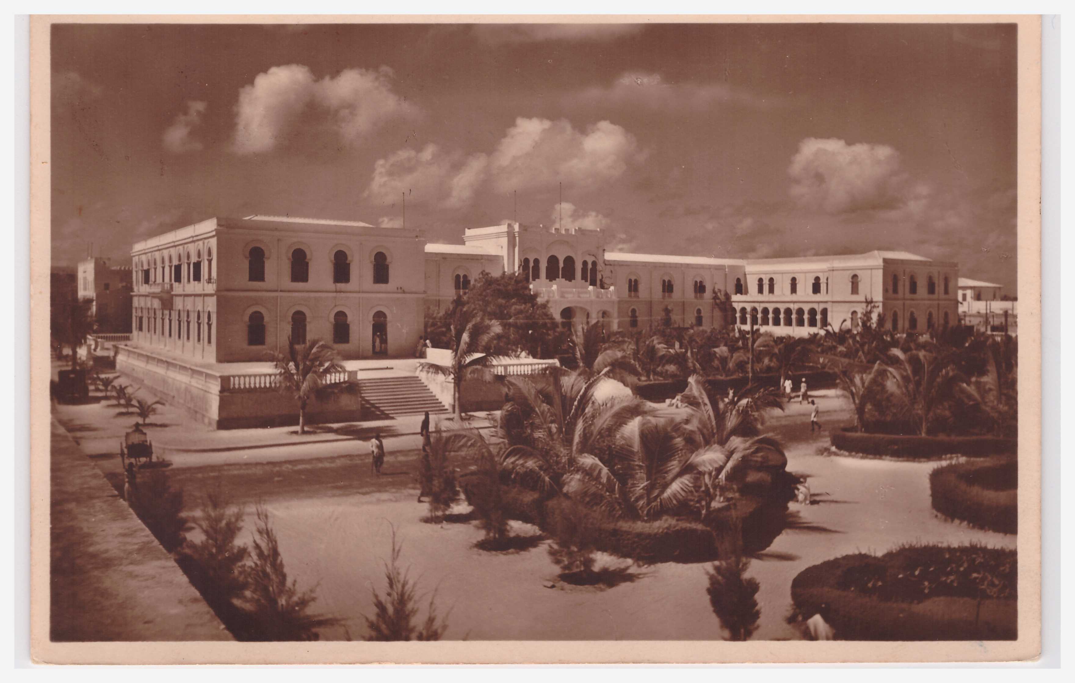 Posted 22/6/1938
“Palace of the Governor”, which later became the office of the Municipality of Mogadishu until around 1987.
Located opposite to the Cathedral. Hotel Croce del Sud, is located to the right of this building.
Mogadiscio (Somalia Italiana) Veduta di Amaruini
 Click on photo to enlargen
Looking towards Fakr ad-Din Mosque in the centre, between two new Italian buildings. With Hamar Weyne (Amaruini) behind.
Add your comments
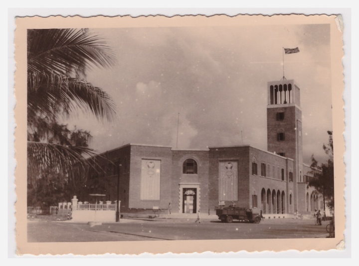
Mogadiscio – La Dogana
 Click on photo to enlarge
La Dogana = The customs
A possible location. What do you think? Your comments could help?
Somalia – Mogadiscio – Una nuova costruzione
 Click on photo to enlargen
Location unknown. Leave your comments if you can help
Mogadishu: Inside the old port
 See the port entrance gates to the middle left and the “binoculars” to their right. Both can be seen in seperate photos: Somalia – Mogadiscio – L’ingresso all Doganaand Mogadiscio – Piazza 21 April
Somalia – Mogadiscio – L’ingresso all Dogana

Mogadiscio – Villini Incis

Location unknown. If you have any ideas, please post a Comment below
Mogadishu Lighthouse, 1912

From http://www.unc.edu/~rowlett/lighthouse/som.htm
ETH Zurich Creative Commons image

Merca lighthouse, date unknown
Merka Range Rear Light
postcard image courtesy of Michel Forand
http://www.unc.edu/~rowlett/lighthouse/som.htm
9 – Mogadiscio – Palazzo del Governo ed Albergo Croce del Sud

Posted Sept 1952
Text on back of card reads:
Edixz Porro Giuseppe – Libreria Impero
Mogadiscio – Rip. Vietata
Please comment below on the buildings visible in the photo
The location in Mogadishu, as shown by Google Maps

1 comment