Tre Biano building
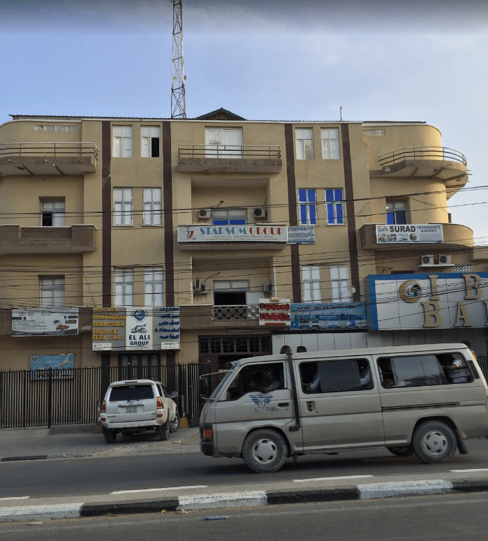
(from Italian “tre piani” meaning “3 floors”? ) On Via Maka-Almukarama, Mogadishu. Seen here on Google maps.
I lived in an apartment here from 1986 to 1989. I would like to know more about the history of this building. Can you help? In the mid-80s it was owned by a family from Hargeysa, who lived on the ground floor (if I am correct). I think it was built sometime in the 1950s, but I may be wrong.

“Mogadiscio – Moschea Scek Ibraim”

Where is it located? Possibly somewhere near or in between the old El Gab market and Xamar Weyne. Please post your suggestions below using the Comment feature.
The same mosque appears in this older postcard below. Taken from the same angle, you can see the same well in front of the mosque..

“Mogadiscio – Mercato Amarnini”
 This copy provided courtesy of Bruce Eady. Possible date: early 1920s. Location unknown, but likely to be in the vicinity of Xamar Weyne.
If you can help with the location please use the Comment facility below
“Mogadiscio – Viale Sorrentino”
 This copy provided courtesy of Bruce Eady. Posted in 1923. Location unknown.
If you can help identify the location please use the Comment facility below
“Somalia – Mogadiscio – In the customs enclosure”
 Approximate location. Lat: 2.036332, Long: 45.351251
View of earliest Italian colonial period wharf
 View looking inland towards Governor’s Palace (later the site of the Al Uruba Hotel)
Note official being carried on a simple type of sedan chair, centre of photo, facing the camera
Postcard posted 1926, but photo may have been taken well before then
Approximate location of camera: Lat 2°02’00.4″N Long 45°20’37.3″E
Colonial period building on the lower Juba
 Photo taken in 1988, at the mouth of the Juba, on the north side of the river.
It could be Italian or English. This area, known as Jubaland, was once under British colonial control
Possible location: Lat and Long 0°14’55.8″S 42°37’04.0″E
-0.248845, 42.617769
“La Cattedrale”

The Cathedral. From a postcard posted in 1950
Destroyed by fire in late 1990/early 1991
Lat and Long: 2°02’08.4″N 45°20’30.0″E
2.035658, 45.341670
“Mogadiscio – Arabo – Somali”

Possibly from Xamar Weyne or Shangani area of the city? Any ideas, if so please leave a Comment
Double click on photo to get a large and more detailed view
“Somalia – Mogadiscio – Albergo Savoia”
 Location found thanks to comment by Ikar below
On the site of the Jirdeh Hussein Building.
Lat and Long: 2°02’09.1″N 45°20’33.9″E
2.035855, 45.342760
Double click on photo to get a large and more detailed view
“Mogadiscio – Albergo Croce del Sud”
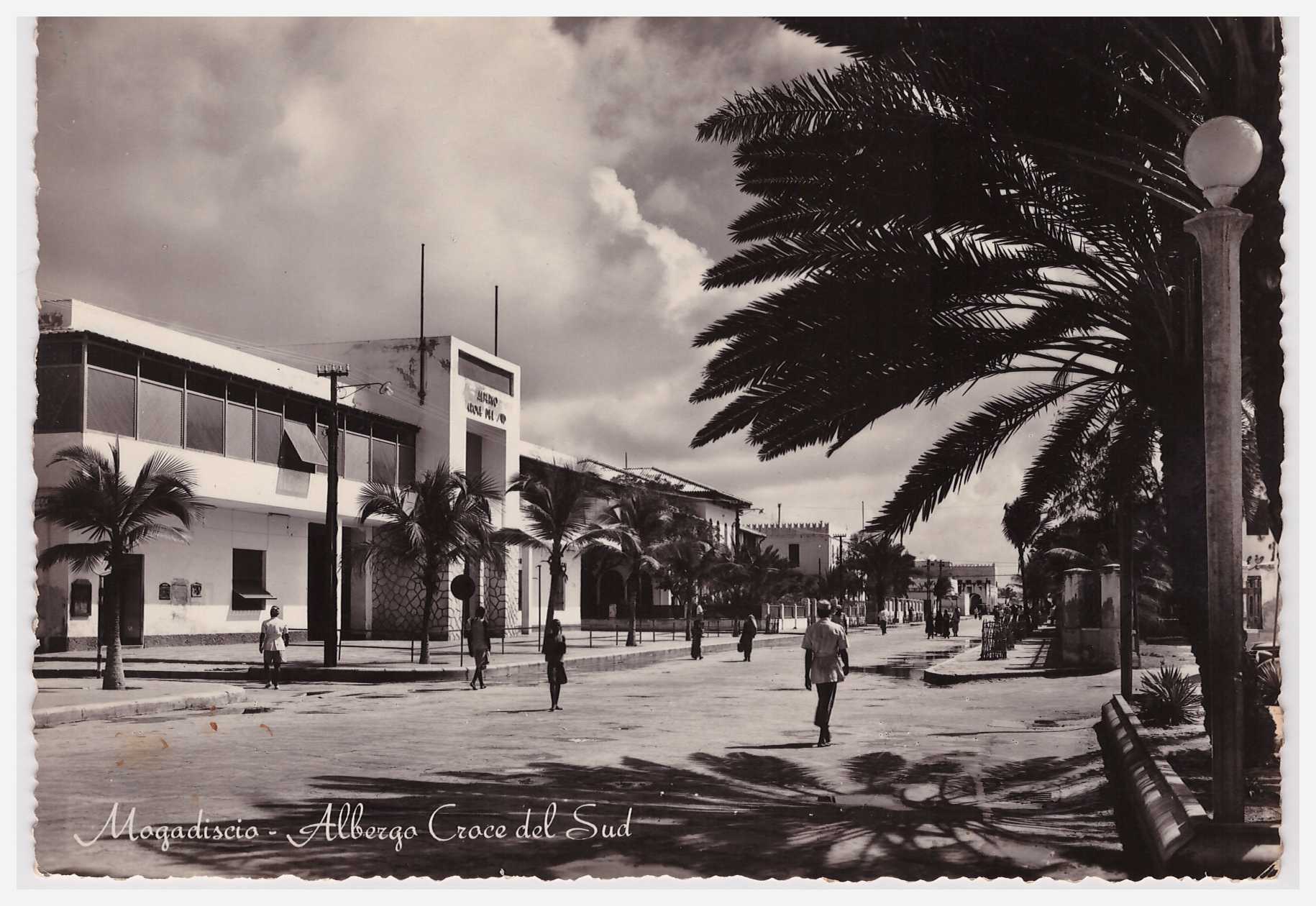 Hotel Southern Cross, in English. But always the Croce del Sud to me
Double click on photo to get a large and more detailed view
Lat and Long: 2°02’06.0″N 45°20’27.7″E
2.035000, 45.341028

This copy courtesy of Bruce Eady, posted in 1936. So is the top photo from the same period?
“Mogadiscio – Panorama del Quartiere di Amarnini”
 “Amarnini” being Xamar Weyne
Double click on photo to get a large and more detailed view
If you know where in Xamar Weyne (or elsewhere) this photo was taken, please leave a Comment
Aerial view of Mogadishu, circa 1938
 “Somalia Italiana Mogadiscio – Panorama”
Double click on photo to get a large and more detailed view
“Mogadishu, the white city on the shores of the Indian Ocean”

“Mogadishu, the white city on the shores of the Indian Ocean”
From “L’Illustration” No.4799, 23 February 1935
Double click on photo to get a large and more detailed view
Interior views of the Garessa (when used as a museum)

Undated postcard, but likely to be from the 1950s
Undated postcard, but likely to be from the 1950s
Location on Google Maps
For other views of the Garessa at different points in time, see these postings:
“Chiesa del Sacro Cuore” (Church of the Sacred Heart)
 Destroyed during the civil war, in the early 1990s. Now a squatter area.
Location as seen on Google Maps

Street scene in Xamar Weyne
 Untitled but taken in Xamar Weyne, possibly dated 2/3/1914

leave a comment