“Mogadiscio – Arabo – Somali”

Possibly from Xamar Weyne or Shangani area of the city? Any ideas, if so please leave a Comment
Double click on photo to get a large and more detailed view
“Somalia – Mogadiscio – Albergo Savoia”
 Location found thanks to comment by Ikar below
On the site of the Jirdeh Hussein Building.
Lat and Long: 2°02’09.1″N 45°20’33.9″E
2.035855, 45.342760
Double click on photo to get a large and more detailed view
“Mogadiscio – Albergo Croce del Sud”
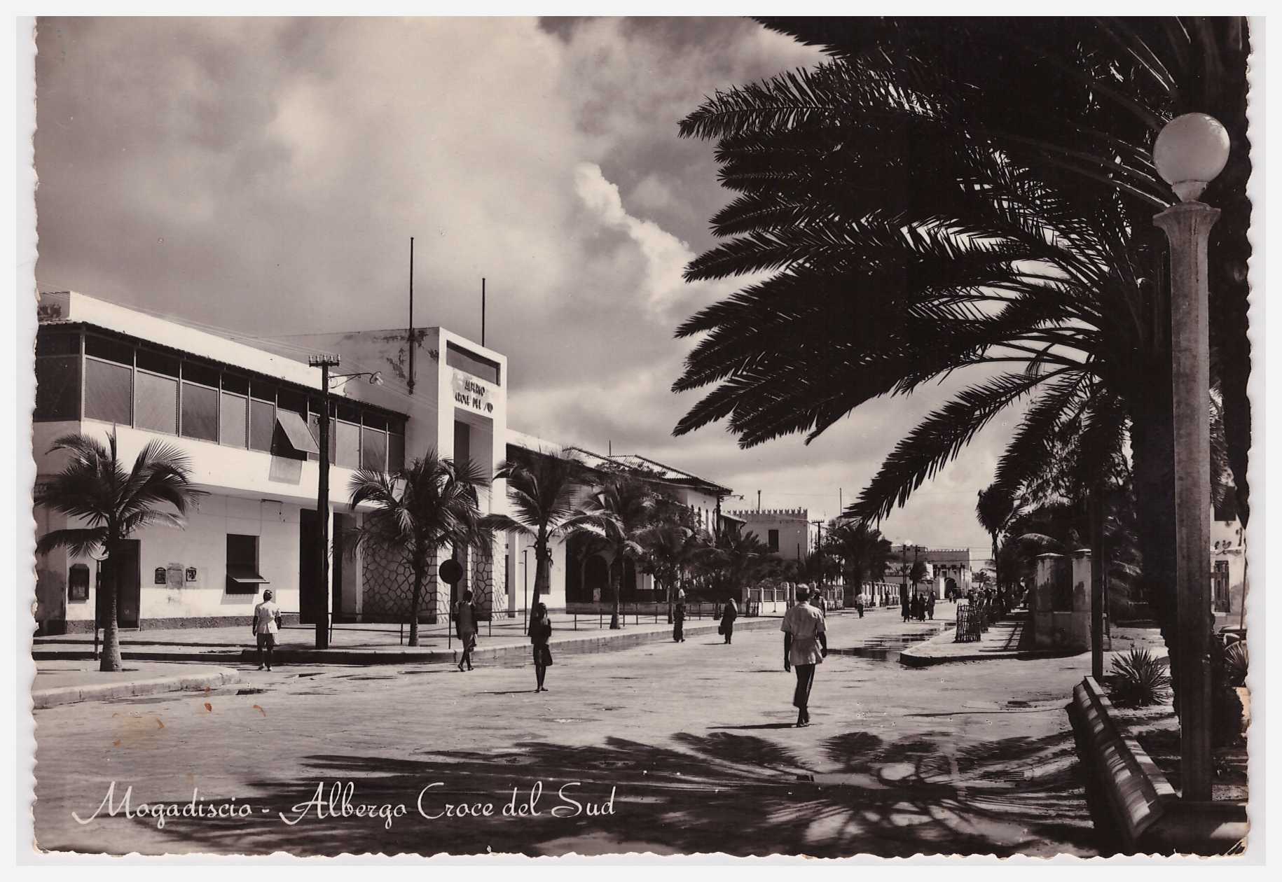 Hotel Southern Cross, in English. But always the Croce del Sud to me
Double click on photo to get a large and more detailed view
Lat and Long: 2°02’06.0″N 45°20’27.7″E
2.035000, 45.341028

This copy courtesy of Bruce Eady, posted in 1936. So is the top photo from the same period?
“Mogadiscio – Panorama del Quartiere di Amarnini”
 “Amarnini” being Xamar Weyne
Double click on photo to get a large and more detailed view
If you know where in Xamar Weyne (or elsewhere) this photo was taken, please leave a Comment
“Mogadiscio – Campo Militaire”
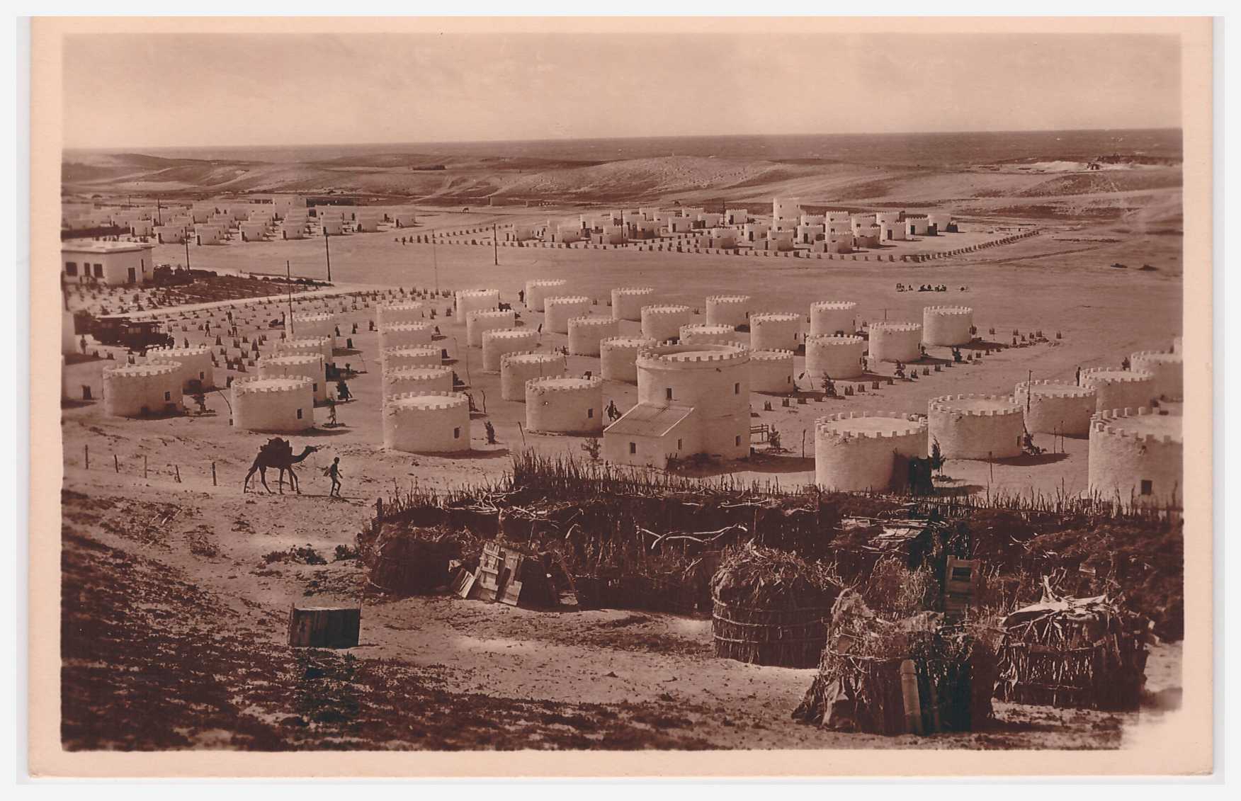 Military camp, location unknown. If you know where it was, please leave a Comment
Double click on photo to get a large and more detailed view
See other photos of what seems to be the same camp here:
https://mogadishuimages.wordpress.com/2008/07/20/mogadiscio-campo-militare/
https://mogadishuimages.wordpress.com/2013/04/20/mogadiscio-campo-amnara/
Aerial view of Mogadishu, circa 1938
 “Somalia Italiana Mogadiscio – Panorama”
Double click on photo to get a large and more detailed view
“Mogadishu, the white city on the shores of the Indian Ocean”

“Mogadishu, the white city on the shores of the Indian Ocean”
From “L’Illustration” No.4799, 23 February 1935
Double click on photo to get a large and more detailed view
Interior views of the Garessa (when used as a museum)

Undated postcard, but likely to be from the 1950s
Undated postcard, but likely to be from the 1950s
Location on Google Maps
For other views of the Garessa at different points in time, see these postings:
“Chiesa del Sacro Cuore” (Church of the Sacred Heart)
 Destroyed during the civil war, in the early 1990s. Now a squatter area.
Location as seen on Google Maps

Street scene in Mogadishu

Location and date unknown. If you have any ideas, please leave a comment below
Hand weavers of Mogadishu cloth

Possibly in Xamar Weyne, where weaving like this continued until the 1980s
Traditionally done by the slave section of the Xamar population, known as (h)abash or adoon
The text below is from “The Politics of Dress in Somali Culture” By Heather Marie Akou, 2011

See also an engraving of a similar scene from the 1880s, here.
Street scene in Xamar Weyne
 Untitled but taken in Xamar Weyne, possibly dated 2/3/1914
“Mogadiscio – Il mercato”
 Where was this photo taken? I think it is somewhere near the gold market (the arches in the distance?), but I am not sure. Leave a comment if you can help
1750 French map of the north east of Africa

Many of the features on this map seem largely imaginary. Some of the names on the Somalia coast are of trading ports known in antiquity but no long in existence in 1750 e.g. Opone, Mosylon, Avalites and Maleos


2 comments