2nd World War period – British occupation
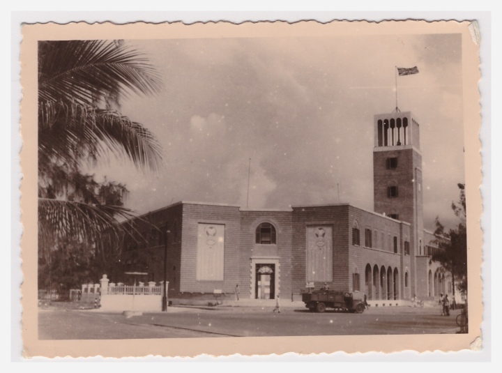 Text on back says “Late Fascist Headquarters. Now Troop Headquarters, Mogadishu”
Lat and Long: 2°02’18.9″N 45°20’29.6″E
2.038593, 45.341569
This became the home of the Parliament, post independence. What was its use before then?
 Text on back says “Another view of the Mosque, Mogadishu. From further up the beach”
Where is this?
 Text on the back says “A well on the outskirts of Mogadishu”
Is this Mosque Sheik Sufi in the background? Your comments below please?
 Text on the back says “Mosque on the seashore, Mogadishu”
Where is this? Leave your comments below
 Text on the back says “Another view of the high school in the centre of the town, Mogadishu”
Where is this exactly?
Somaliland Protectorate, 1948
 “Compiled and Drawn by the Directorate of Colonial Surveys. Photolithographed and printed by War Office, 1948”
Click on image to enlarge

leave a comment