Tre Biano building
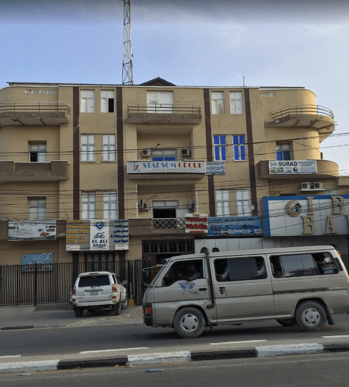
(from Italian “tre piani” meaning “3 floors”? ) On Via Maka-Almukarama, Mogadishu. Seen here on Google maps.
I lived in an apartment here from 1986 to 1989. I would like to know more about the history of this building. Can you help? In the mid-80s it was owned by a family from Hargeysa, who lived on the ground floor (if I am correct). I think it was built sometime in the 1950s, but I may be wrong.
“Mogadiscio – Moschea Scek Ibraim”

Where is it located? Possibly somewhere near or in between the old El Gab market and Xamar Weyne. Please post your suggestions below using the Comment feature.
The same mosque appears in this older postcard below. Taken from the same angle, you can see the same well in front of the mosque..

“La Cattedrale”

The Cathedral. From a postcard posted in 1950
Destroyed by fire in late 1990/early 1991
Lat and Long: 2°02’08.4″N 45°20’30.0″E
2.035658, 45.341670
“Mogadiscio – Albergo Croce del Sud”
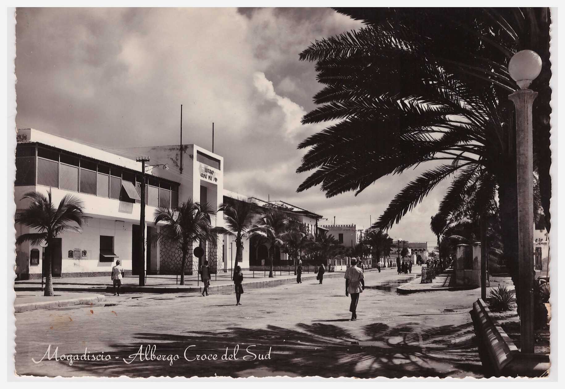 Hotel Southern Cross, in English. But always the Croce del Sud to me
Double click on photo to get a large and more detailed view
Lat and Long: 2°02’06.0″N 45°20’27.7″E
2.035000, 45.341028

This copy courtesy of Bruce Eady, posted in 1936. So is the top photo from the same period?
Interior views of the Garessa (when used as a museum)

Undated postcard, but likely to be from the 1950s
Undated postcard, but likely to be from the 1950s
Location on Google Maps
For other views of the Garessa at different points in time, see these postings:
“Chiesa del Sacro Cuore” (Church of the Sacred Heart)
 Destroyed during the civil war, in the early 1990s. Now a squatter area.
Location as seen on Google Maps

“Mogadiscio – Il mercato”
 Where was this photo taken? I think it is somewhere near the gold market (the arches in the distance?), but I am not sure. Leave a comment if you can help

“Mogadiscio – Mercato Amaruin”
 Meaning “Xamar Weyne market”. Location of the gold market in the 1980s
“Somalia Italiana – Il te (ciai) della cinque”
 Click on photo to enlarge
Where is this location? In the background are what look like three or four sandy roads heading uphill and away from the photographer. These may be the outskirts of Mogadishu at the time.
Note the silver jewelery worn by the women. Similar if not the same as the item below, in the case of the women on the left (click to enlarge, twice)

“Mogadiscio – Panorama”
 View from Cathedral towards the sea, looking over the Palace of the Governor, in the 1950s(?)
Mogadiscio – Piazza 21 Aprile
 Click on photo to enlargen
Entrance to what was known (in the 1980s) as “the old port” is on the left
Text inscription is largely unreadable on the original photo
Mogadiscio – Piazza 21 April
 Still intact in the 1980’s and known then to expatriates in Mogadishu as “the binoculars”
The entrance to the old port is visible on the left. The sea is in the distance.
What was important about 21 April? Leave your Comment below
Mogadishu – Scogliera

“Cliff”
The two people in the middle foreground are standing either side of the Italian “fasces” symbol
The building on the corner was a fish market
9 – Mogadiscio – Palazzo del Governo ed Albergo Croce del Sud

Posted Sept 1952
Text on back of card reads:
Edixz Porro Giuseppe – Libreria Impero
Mogadiscio – Rip. Vietata
Please comment below on the buildings visible in the photo
The location in Mogadishu, as shown by Google Maps
Mogadiscio – Panoramica dal mare
 Posted October 1952
Text on card reads:
11 – Ediz. Fotocine – Mogadiscio
Neg. Cav. Uff. M. Spialtini
Please comment below on the buildings visible in the photo
The location in Mogadishu, as shown by Google Maps
Mogadiscio – Palazzo degli Uffici dell’ A.JF.J.S
 The Municipality of Mogadishu offices until late 1980’s
Located opposite the Cathedral, and with Croce del Sud Hotel to the right
Ruins visible in the centre of the Google maps image below

Mogadiscio – Museo della Garessa

Postcard posted in 1950
A representative of the Sultanate of Oman, and later on the Sultanate of Zanzibar, was based here in the 19th century.
View all the other photos containing the Garessa
See the ruins of the Garesa in the centre of the picture below

leave a comment